
Page 29 - hisdeSAT annual report 2012
P. 29
HIGHTLIGHTS 2012
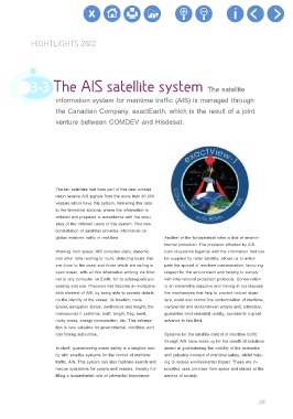
3.3 The AIS satellite system The satellite
information system for maritime traffic (AIS) is managed through
the Canadian Company, exactEarth, which is the result of a joint
venture between COMDEV and Hisdesat.
The ten satellites that form part of this new constel-
lation receive AIS signals from the more than 80.000
vessels which have this system, delivering this data
to the terrestrial stations, where the information is
collated and prepared in accordance with the requi-
sites of the different users of this system. This new
constellation of satellites provides information on
global maritime traffic in real time Another of the fundamental roles is that of environ-
mental protection. The precision afforded by AIS
Working from space, AIS compiles static, dynamic control systems together with the information that can
and other data relating to route, detecting boats that be supplied by radar satellite, allows us to antici-
are close to the coast and those which are sailing in pate the spread of maritime contamination, favouring
open ocean, with all this information arriving via Inter- respect for the environment and helping to comply
net to any computer on Earth, for its subsequent pro- with international protection protocols. Conservation
cessing and use. Precision has become an indispens- is an inalienable objective and having at our disposal
able element of AIS, by being able to provide details the mechanisms that help to prevent natural disas-
on the identity of the vessel, its location, route, ters, avoid and control the contamination of maritime,
speed, navigation status, destination and freight, the continental and subterranean waters and, ultimately,
manoeuvres it performs, draft, length, flag, swell, guarantee environmental quality, represents a great
rocky areas, energy consumption, etc. This informa- advance in this field.
tion is very valuable for governmental, maritime, port
and fishing authorities. Systems for the satellite control of maritime traffic
through AIS have made up for the dearth of solutions
In short, guaranteeing ocean safety is a tangible real- aimed at guaranteeing the viability of the extensive
ity with satellite systems for the control of maritime and palpable concept of maritime safety, whilst help-
traffic, AIS. This system can also facilitate search and ing to reduce environmental impact. These are in-
rescue operations for people and vessels, thereby ful- novative uses provided from space and placed at the
filling a humanitarian role of primordial importance. service of society.
29