
Page 24 - memoria_hisdesat_2020
P. 24
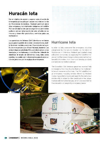
Huracán Iota


           Con el objetivo de ayudar a superar esta situación de
           emergencia provocada por causas naturales en la isla
           de  Providencia  (Colombia),  Hisdesat  participó  entre
           otras empresas, suministrando imágenes del satélite
           PAZ con el objetivo de que los organismos pertinentes
           pudieran extraer información de valor añadido de las
           mismas y desarrollar productos y servicios para uso
           institucional.

           Los operativos de Defensa Civil Colombiana recibieron
           ayuda para la gestión de la crisis y de esta forma, facili- Hurricane Iota

           tar la tomar medidas y acciones. El servicio de cartogra-
           fía de emergencias que ofrece Hisdesat, haciendo uso   In order to help overcome the emergency situation
           de las imágenes satelitales PAZ, permite localizar zonas   precipitated by the natural disaster on the island of
           inundadas, si las hubiesen, y cuantificarlas. Además de   Providencia in Colombia, Hisdesat participated along
           identificar  el  estado  de  elementos  clave,  tales  como   with other companies, by supplying PAZ satellite ima-
           puentes, los cuales son indispensables para la evacua-  ges so that the relevant organizations could extract va-
           ción de personas por los equipos de emergencia.    lue-add information from them and develop products
                                                              and services for institutional use.


                                                              The Colombian Civil Defence operatives received help
                                          © Hisdesat          in managing the crisis, thus facilitating the implemen-
                                                              tation of measures and actions. The PAZ satellite ima-
                                                              ge  emergency  mapping  service offered  by  Hisdesat
                                                              makes it possible to locate and quantify flooded areas.
                                                              Additionally, it allows for the identification key infras-
                                                              tructure elements like bridges, which are essential for
                                                              the evacuation of people by emergency teams.


                                                                                                             © Hisdesat


      24   | HISDESAT |   INFORME ANUAL 2020